
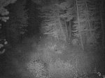
Our motion-activated cameras caught one more lion! This one was wondering about on October 23rd, 2014, around 7pm. It is somewhat unusual for lions to be active so early in the evening!

Our motion-activated cameras caught one more lion! This one was wondering about on October 23rd, 2014, around 7pm. It is somewhat unusual for lions to be active so early in the evening!


There are mountain lions active near Tahoe Donner! These images were taken by camera traps set in nearby places. The mountain lions seem to be active especially at night. As they have a large range, we are not sure if there is only one of them, or multiple ones; the images were all taken within a few miles one from the other.
We place camera traps (motion-activated cameras) in nearby valleys, in spots where we have seen signs of wildlife. Finally, we were able to catch a bear!

Bear! June 5, 2012, 6:30am.
There is some light snow on the ground — around Truckee it can snow even in June!
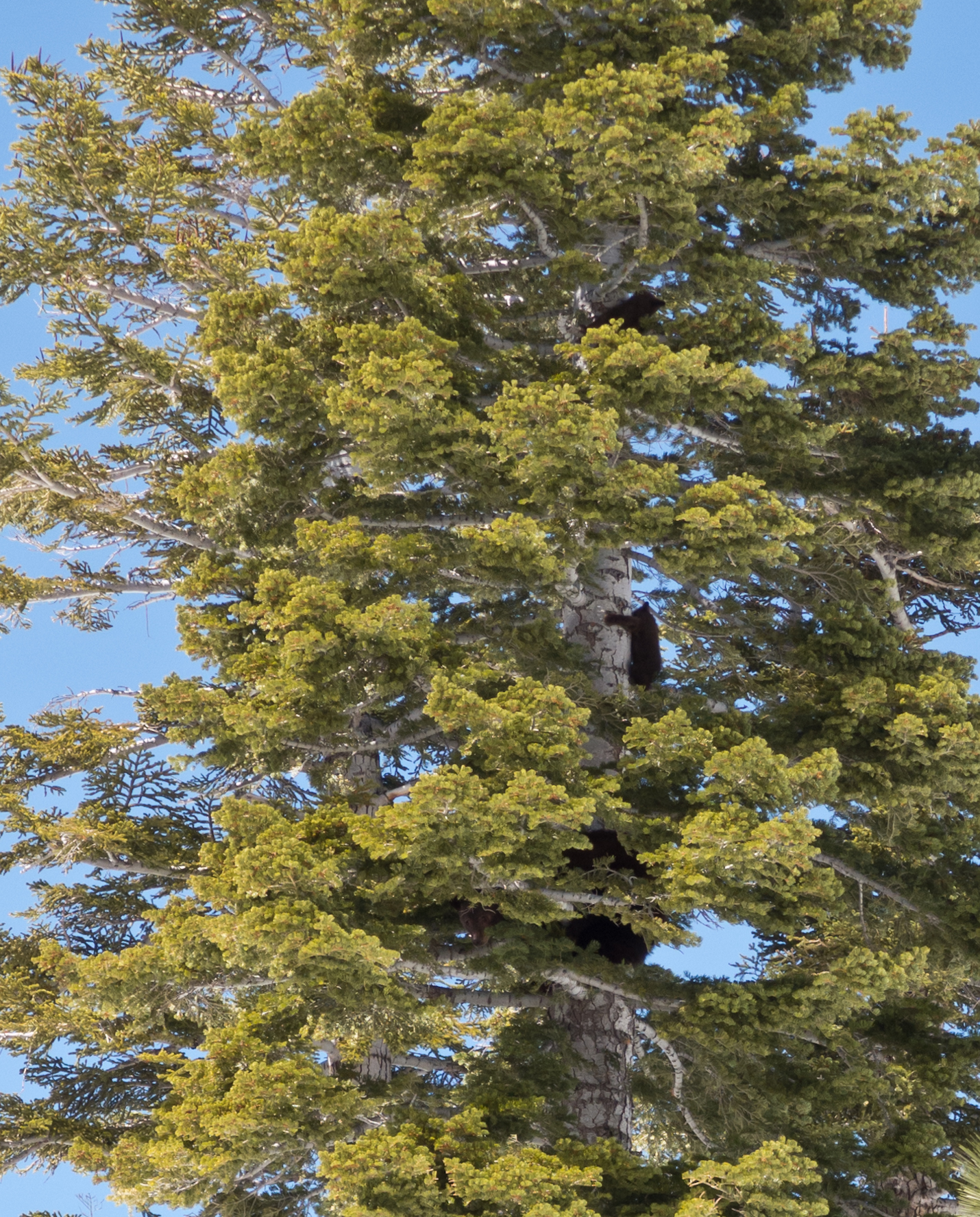
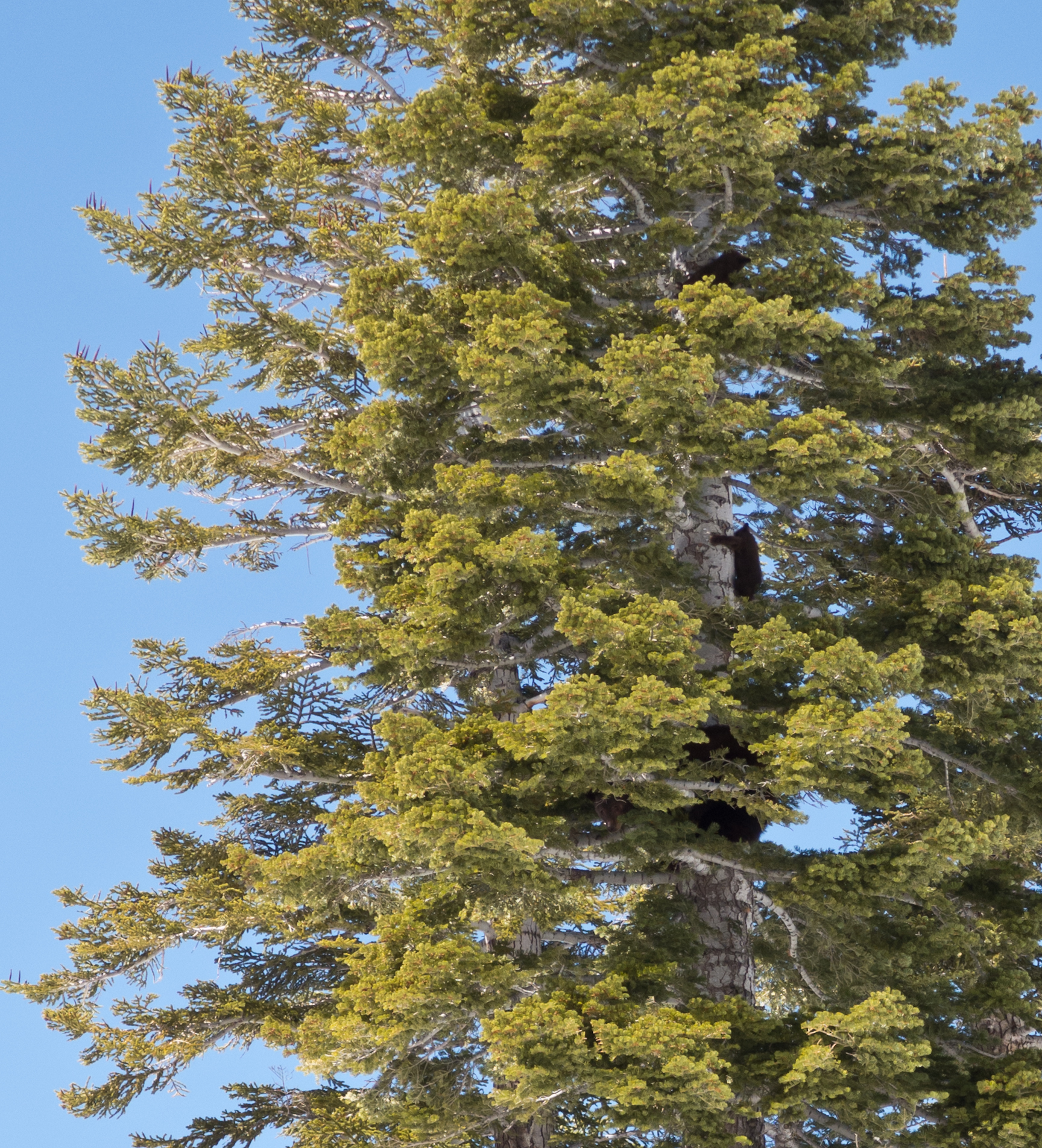
We were hiking around Hawks Peak, in Tahoe Donner, when we spotted bear tracks:

They were very large, and also very fresh. And a dark shadow moving on a tree nearby caught our eye. The bear! With three cubs! Climbing on a tree!
Mother bear had evidently heard us coming, and had sent her three cubs up a tree, to protect them, and was herself climbing the tree. She was huge, the biggest bear we have seen so far (and we have seen many, from Sequoia Natl Park, to Yosemite).
It’s never a good idea to be around a mother bear with cubs; luckily in this case, the mother had sent her cubs up a tree, and so she was unlikely to attack to protect the cubs unless we came closer. We promptly backtracked, and while going back, we managed to quickly get a few shots of the bear and her cubs. They were quite far up the tree; they were excellent climbers.

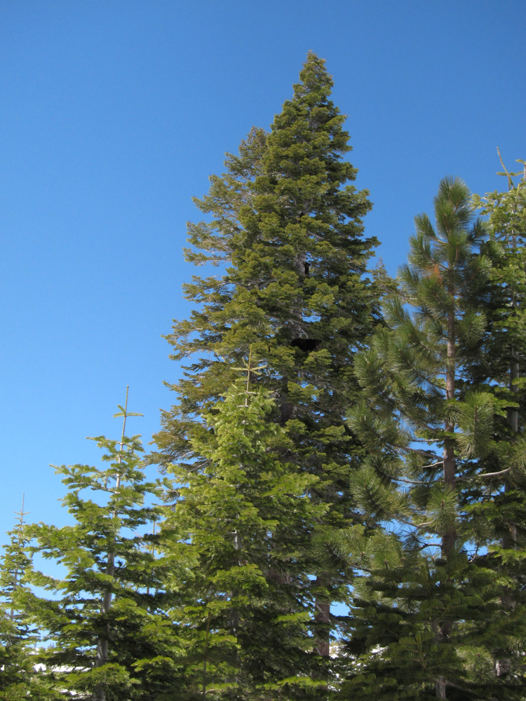


We later heard that a bear spent the winter under a balcony in Tahoe Donner… we wonder whether it was this bear.
Some time ago I posted some instructions on how to create on-line topo maps of hikes / excursions, starting from GPX files. Joseph Elfelt of Gmap4 has recently written to me, announcing the availability of new, and much improved maps. I checked the new maps out, and the quality and detail is simply stunning!
To get a map, you must first upload the GPX file somewhere (Google Sites works well). Once you have an URL for your GPX file, such as
http://share.jointwork.net/tdr_file_site/tracks/Lola_Montez_One_Way.GPX
then you can generate a high-resolution topographical map of the GPX trail by creating the URL as follows:
http://www.mappingsupport.com/p/gmap4.php?q=http://share.jointwork.net/tdr_file_site/tracks/Lola_Montez_One_Way.GPX&t=t4
The “t=t4” parameter above selects new very high-definition topographical maps that are simply stunning to look at — better than any other ones I have seen.
If you use and appreciate the service, Joseph tells me that he would appreciate donations, to help with the cost of hosting and serving map quads (I should add that I have no relation to him, except of being a very happy user of his maps).
This is what Joseph wrote about how these new maps were created (reproduced with permission):
The person behind CalTopo.com is Matt Jacobs and his site is running the ‘civilian’ version of a map tool that he originally wrote to support wilderness search and rescue (SAR) activity. Matt’s desire for the highest quality topographic maps coincided with a massive project by the U.S. Geological Survey to make very high quality scans (660 pixels per inch) of all the topographic maps they had previously published. These scans are online as ordinary PDF files, they are not the new GeoPDF file format.
A vast amount of work was done by Matt to invent a system that would process those new very high quality USGS scans into map ‘tiles’ suitable for display by software (like Gmap4) which uses the Google Maps API (Application Program Interface). These newly created map tiles are hosted on the Amazon servers. There are some blog posts on Matt’s website that provide some insight into the processing steps needed in order to convert the USGS scans into high quality map tiles.
In late 2011 Matt contacted me and inquired if I would like to display his tiles with Gmap4. Since the scan quality of these map tiles is significantly better than anything else available and the tiles do not have any watermarks or ads, I quickly agreed. You can compare these map tiles (t4 Topo High) and the user-selected amount of hill shading (Menu ==> Hill shading) to any other online topographic maps and decide for yourself which maps look best.
Ultimately whether or not Gmap4 can continue to display these watermark-free state-of-the-art adjustable-hill-shading topographic maps will be up to you along with the other Gmap4 users. If you enjoy using Gmap4 and Matt’s best-of-their-kind maps, please consider making a donation that I can share with Matt.
Kudos to Matt and Joseph for making such great maps available to us all!
The legend says that in cold winter days, the ghost of Lola Montez can be heard moaning at her namesake lake in the Sierra. We went to check yesterday, and we clearly heard repeated moans coming from the frozen lake. We recorded a few of them. A spectral analysis reveals that Lola had an unsually low voice, with a distinct frequency peak at around 154 Hz.
(Note: you should listen to the recordings using headphones; laptop speakers generally cut off low frequencies.)


You can download the audio here.

Coyote in Tahoe Donner. January 2, 2012, 7:29am
Our “animal camera” caught sight of a coyote at 7:29am, Jan 2, 2012!
We knew there were many coyotes around (they were howling at the Moon behind our house during the Thanksgivings weekend), but this is the first photo of them we were able to get.
We added many new hike and mountain-bike ride descriptions. For each ride or hike, we give a map, and length and elevation data; we plan to add more complete hike and ride descriptions in due time. Most of the hikes and rides are suitable for families, and we hope that the map and GPS data we provide will be sufficient for you to form an idea of their difficulty and length. All of the rides and hikes are quite beautiful – we hope you will enjoy them.
When I first arrived in California many years ago, it was difficult to find good topographical maps. Sure, you could buy maps of Yosemite or Sequoia National Parks (at 1:62,000 scale or somesuch), but if you wanted to buy a map of a random place where you thought it would be fun to hike, you were mostly out of luck. The local REI might have had some maps, but without complications or preordering, it wasn’t easy.
Now, instead, it is maps nirvana. You can have free topo maps of most places in the US on your Mac / PC! Here is how.
Head over to Garmin, and download their excellent Garmin Basecamp software. Install also Garmin MapInstall and MapManager (here is a link for the Mac version). Then, head over to GPS File Depot, and download free maps. The ones I prefer are those by John_M; for the Western US in particular I recommend this one.
You can install the maps on your Mac (or Windows box, I guess), and use them from Garmin Basecamp. It is simply wonderful. Of course, Google Earth is also very good to explore places, but I find the ability to view and print topo maps invaluable for hiking. And perhaps it’s just me, but I still get more information out of a good topo map than out of Google Earth, when it comes to hiking.
I want to tell you how to obtain great maps of your hikes, such as this one of the hike from Squaw Valley to High Camp.
First, you need to record a GPX track file describing the hike. Most GPS can record a GPX track (I personally use a Garmin 62st; I will write later about it). Android and iPhone phones can also record such tracks. My favorite app for recording GPX tracks on Android is Maverick, which has support for offline maps from many sources.
I then edit the tracks using Garmin Basecamp, a free application from Garmin which lets you (among other things) view and edit GPX tracks. I edit the tracks removing any portion that is unrelated to the hike (such as the driving to the trailhead, or any side-trips that are not part of the main hike). To view and edit the tracks in context, I generally load in Basecamp some free base maps obtained from gpsfiledepot; my favorite maps are the California Topo and the maps for the South West and North West.
Once the GPX tracks are edited, I use the excellent gmap4 service to obtain maps displaying the GPX tracks. To this end, I upload the tracks to a web server, and I form an URL of this form:
http://www.mappingsupport.com/p/gmap4.php?q=http://share.jointwork.net/tdr_file_site/tracks/Squaw_to_Shirley_and_High_Camp.GPX&t=t4
which, when you follow it, produces a map like this.


You must be logged in to post a comment.